Thornapple River Kayaking Adventure: Irving Road Boat Launch to Indian Valley Campground
A late-winter paddle of about 10 miles on the middle Thornapple River — snow-lined banks, one dam portage in the village of Middleville, and a cold, clear February day in Barry County.
Wild Rivers. Rugged Trails. Real Adventure.
Trip Overview: Kayaking the Thornapple River from Irving
On Sunday, February 26, 2023, the West Michigan Kayaking Club paddled approximately 10 miles of the Thornapple River, traveling downstream from the Irving Road Boat Launch to Indian Valley Campground near Middleville, Michigan.
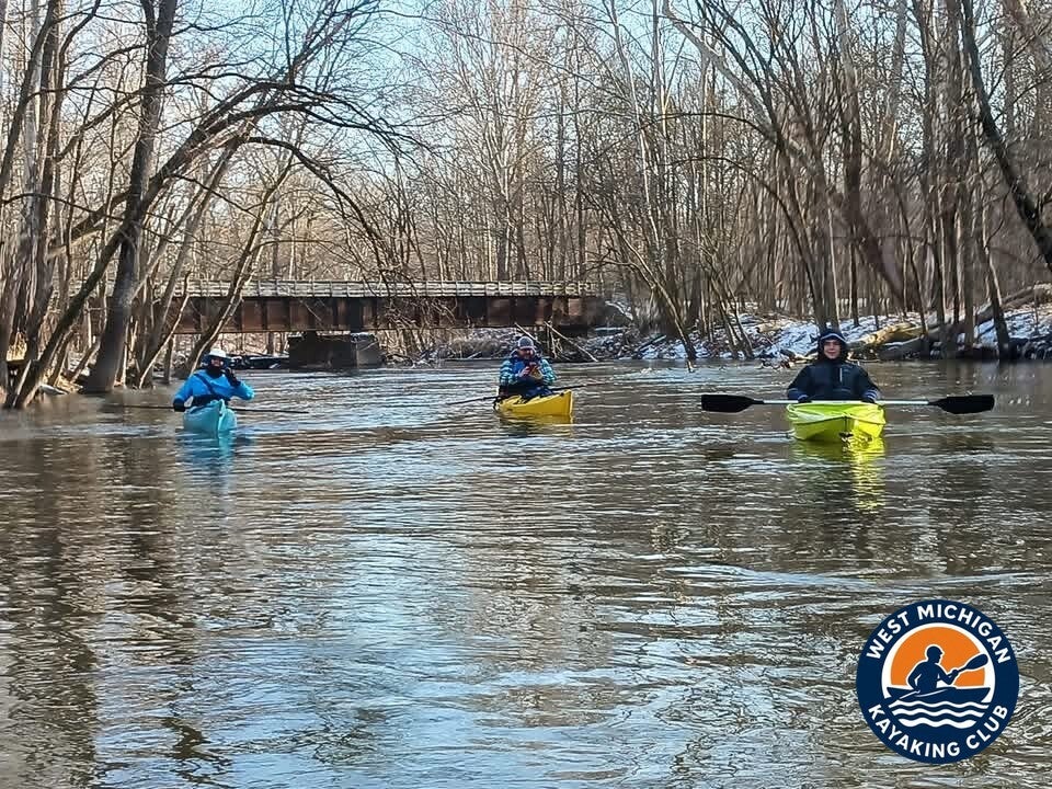
The Thornapple here runs through low, wooded southwest Michigan country — an easygoing stream with mostly gentle current that meanders past farmland and hardwood banks. In late February the corridor is stripped down to its bones: bare trees, snow holding on the shaded banks, and the river running wide and cold under a bright sky.
This is an active paddling day, not a lazy drift. The route includes a working portage around the dam in the village of Middleville, and February water demands full cold-weather gear and steady paddling from launch to take-out.
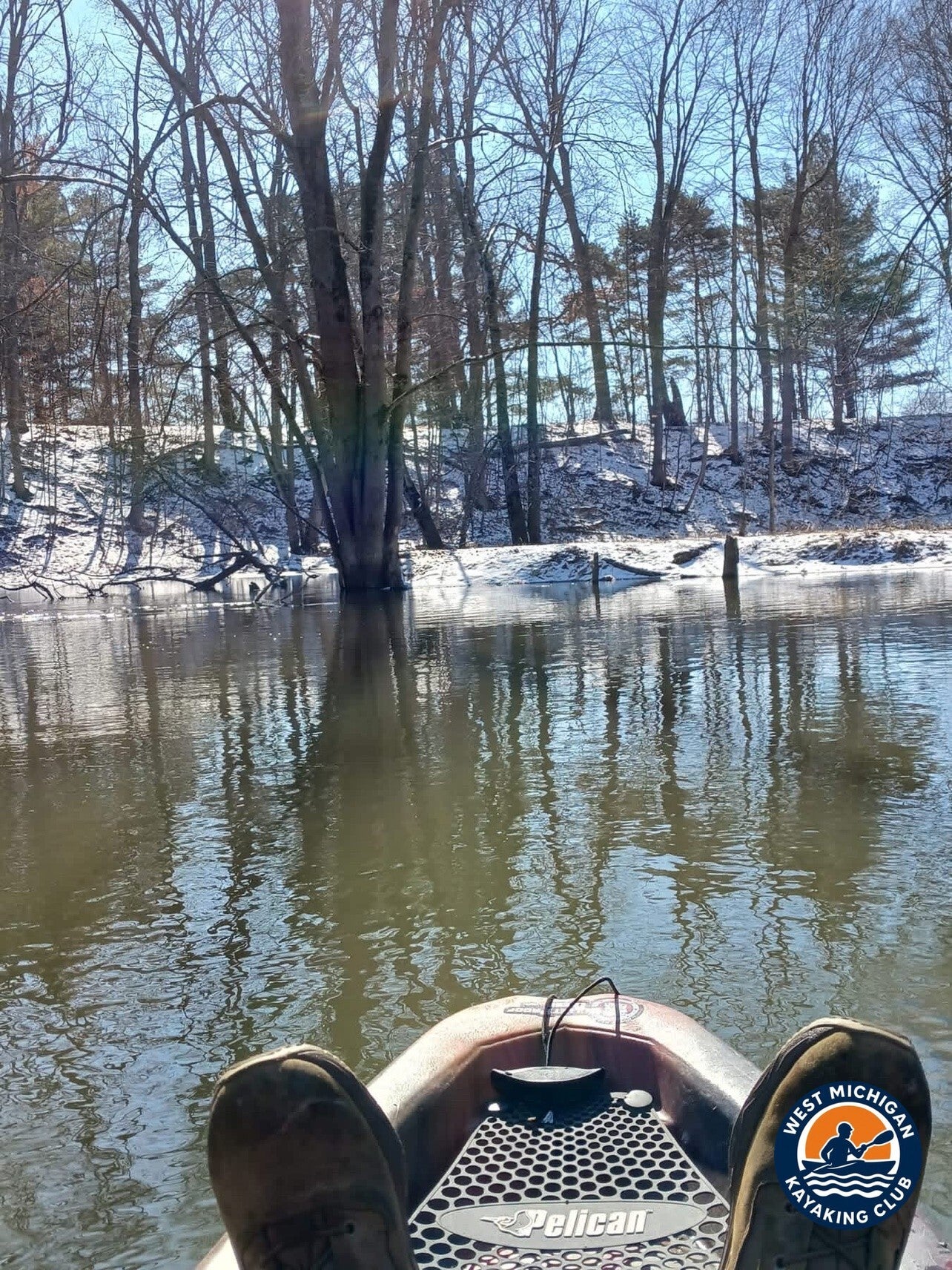
1. The Put-In: Irving Road Boat Launch
Location: Irving, Michigan (Barry County)
GPS: 42.6892, -85.4256
Launch coordinates are the Irving Road crossing at the USGS gage location (USGS 04117600, Thornapple River at Irving Road) — confirm the exact parking and put-in spots on a map before you go. The club's Thornapple River guide lists the Irving access as a free public launch with no fee.
A February launch means gearing up for the water, not the air: dry layers, gloves, and everything stowed in dry bags before the first boat touches the river. With a one-way downstream route ahead, vehicles were staged at the take-out at Indian Valley Campground before the group launched.
2. The River Journey: Irving Road Boat Launch to Indian Valley Campground
The run starts in the free-flowing middle river below the Irving dam complex, where the Thornapple picks up the Coldwater River and bends through Middleville country. The current had real push behind it: the recorded flow at the Hastings gage that day was 505 cubic feet per second, well above the low summer flows this river is known for, and the channel ran full between snow-dusted banks.
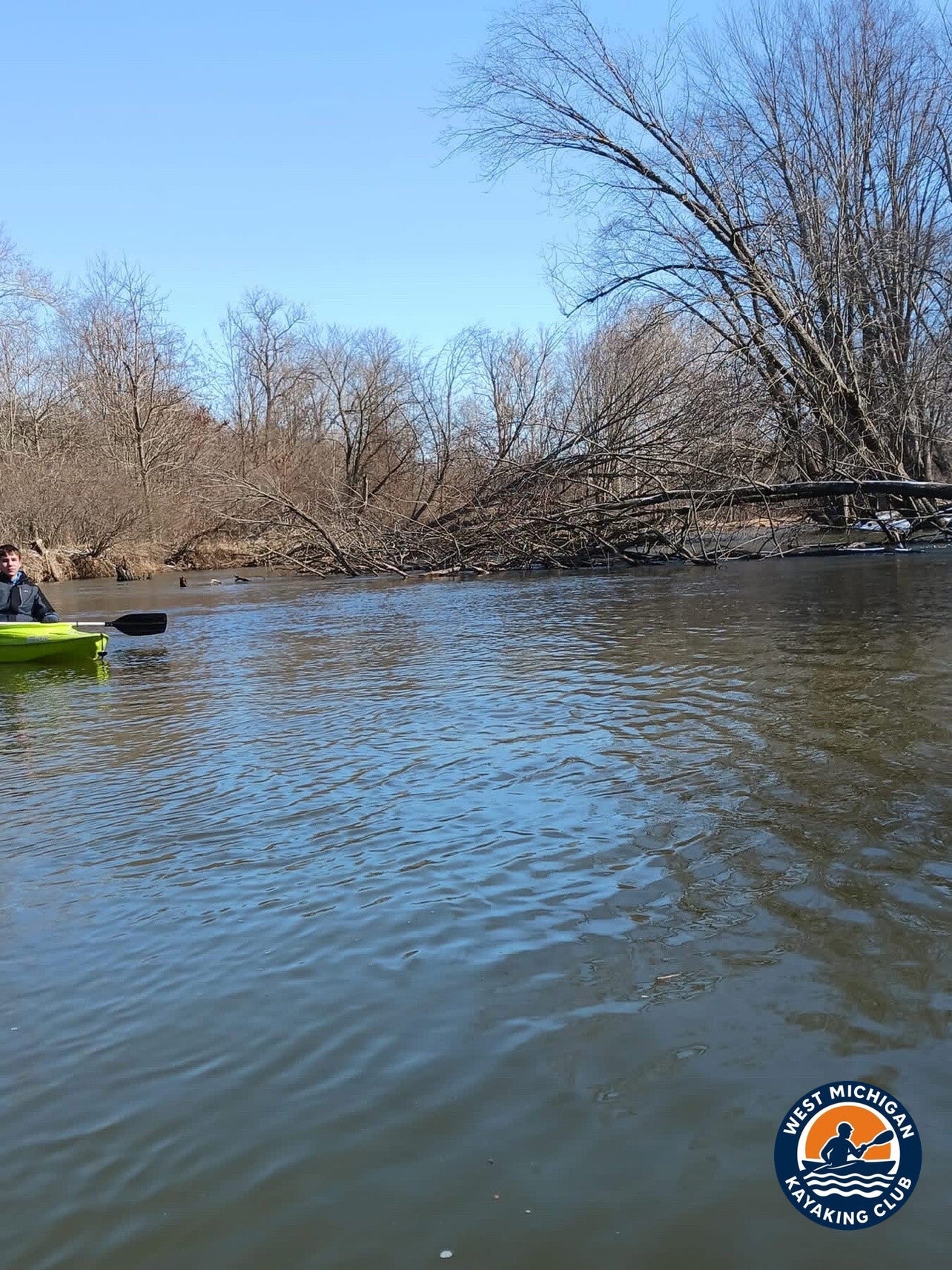
Wood is the standing hazard on the Thornapple, and this trip served up the classic example — a large downed tree lying across the channel, its branches spread over the current. On a winter river there is no casual way around wood: read it early, pick your line, and portage when you are unsure.
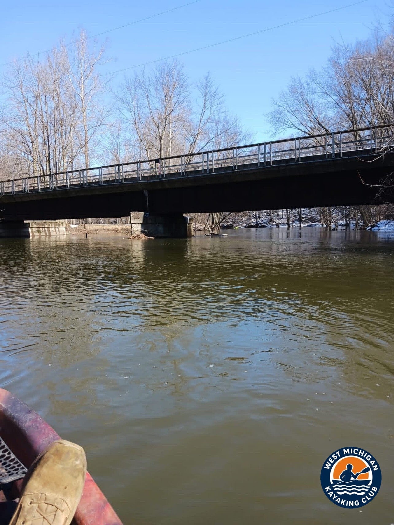
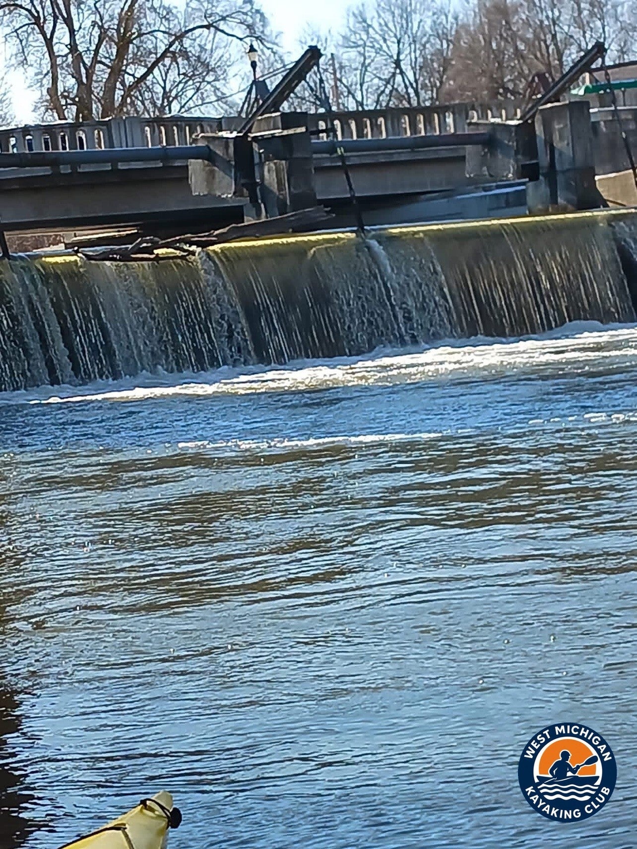
Downstream, the corridor tightens into the village of Middleville. The river passes under a road bridge, and then the day changes rhythm entirely at the Middleville Dam in the center of town, where every paddler leaves the water for the portage carry. Below the dam the river opens up again for the last stretch to Indian Valley Campground.
3. USGS River Flow and Water Conditions
Primary gauge: Thornapple River near Hastings, MI — USGS 04117500
Drainage area at gauge: 385 square miles
Gauge data: USGS monitoring location 04117500
A second USGS gage, 04117600, sits at the Irving Road crossing at the put-in; the recorded daily values used here are from the Hastings gauge, the nearest gage with a published daily record for this date.
Recorded Readings for February 26, 2023
| Daily mean discharge (USGS, recorded) | 505 ft³/s |
|---|---|
| Gauge height (USGS, recorded) | not reported |
| Median daily flow for this date (USGS statistics) | 328 ft³/s |
| Condition vs. normal | Above the median for this date |
The river was running strong for late winter — the day's 505 ft³/s daily mean sits well above the 328 ft³/s median for February 26 in the Hastings gage record (1945–2026), and far above the typical summer flows of roughly 150–250 cfs noted in the club's Thornapple River guide. Higher water keeps the current moving and the channel full, but it also makes downed wood harder to read and clear, which is exactly what the group met below Irving Road.
4. Historical Weather Conditions in Middleville, Michigan
The nearest official National Weather Service observation station is Grand Rapids Gerald R. Ford International Airport (KGRR), roughly 15 miles north of the put-in.
| Temperature at meet time | 28°F (recorded 6:53 AM) |
|---|---|
| Afternoon high | 39°F |
| Sky / cloud cover | Clear to mostly sunny |
| Wind speed and direction | West at 9–16 mph |
| Precipitation | None |
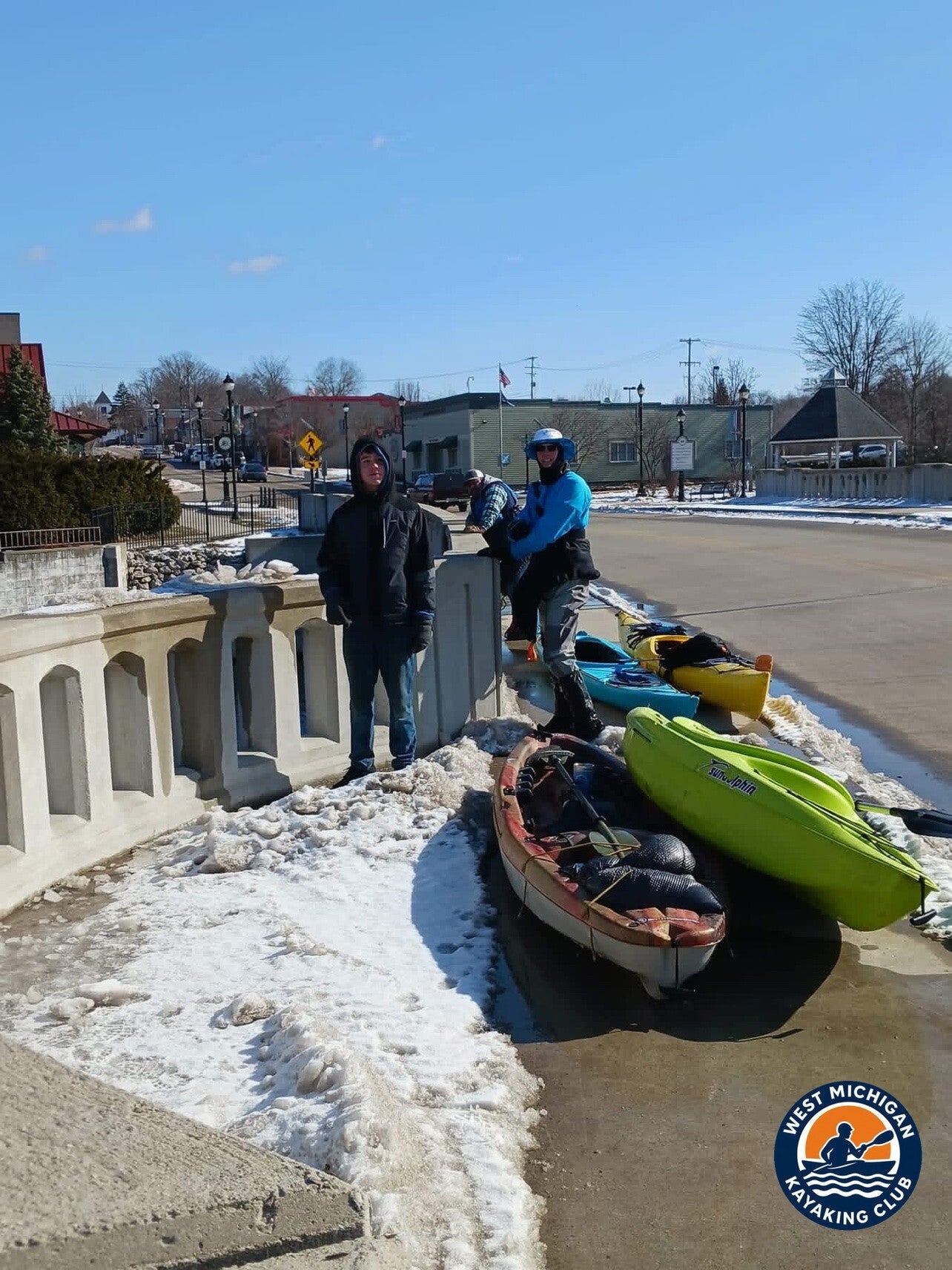
It was a classic late-winter paddling day: a cold start in the upper 20s, warming to just under 40°F by afternoon under a clear blue sky — the bright sun and lingering bank snow in the trip photos match the recorded observations exactly. The west wind kept exposed stretches honest, but the wooded corridor gave the group shelter for most of the run.
5. The Take-Out: Indian Valley Campground
Location: 8200 108th St, Middleville, Barry County, Michigan
GPS: 42.7689, -85.4632
Indian Valley Campground & Livery is the club guide's listed take-out for this stretch of the Thornapple — a private campground and livery on the river north of Middleville, about four river miles below the village launch. After the dam carry and the last open stretch of river, the group came off the water here and closed out a February day that had delivered everything winter paddling promises: cold hands, bright sun, moving water and snow on the banks.
Technical Trip Information
| River | Thornapple River |
|---|---|
| Trip date | Sunday, February 26, 2023 |
| Put-in | Irving Road Boat Launch, Irving — 42.6892, -85.4256 |
| Take-out | Indian Valley Campground, Middleville — 42.7689, -85.4632 |
| Distance | ~10 miles (club guide segments: ~6 miles Irving to Middleville, ~4 miles Middleville to Indian Valley) |
| River character | Mostly gentle current through wooded lowlands (club guide); one mandatory dam portage |
| Water conditions | 505 ft³/s daily mean at USGS 04117500 (Hastings) — above the February 26 median of 328 ft³/s |
| Portages / dams | 1 — Middleville Dam, portage in the village of Middleville |
| Shuttle | Required (one-way downstream trip) |
| USGS gauge | 04117500 — Thornapple River near Hastings, MI |
Safety and Equipment
Participants brought their own kayaks or canoes, paddles, properly fitted personal flotation devices, drinking water, food, weather-appropriate clothing, sunscreen, insect protection and dry bags. On a February river, that means dressing for cold water, not just cold air: insulating layers, gloves, and a change of dry clothes sealed in a dry bag.
Wood is the main hazard on this stretch. Scout every log, never run a strainer, and portage when you are unsure. Never run a dam — take out at the portage well upstream and carry around, as the group did at Middleville.
More Than the Miles
Plenty of paddlers put their boats away in November and wait for May. This trip is the argument for not waiting. A February river in Michigan runs cold and strong, the banks carry the last of the snow, and the corridor belongs to the people willing to dress for it. Between the downed tree below Irving Road and the dam carry in Middleville, the day asked for real paddling — and gave back a river most people only ever see in summer.
Trip Recap
- ~10 miles from Irving Road Boat Launch to Indian Valley Campground
- Recorded flow of 505 cfs at the Hastings gage — well above the late-February median
- One portage: the Middleville Dam, carried through town on a snowy sidewalk
- A downed tree across the channel kept route-finding honest
- Clear skies, a high of 39°F, and snow on the banks from start to finish
Thank you to every member who showed up ready to paddle on a cold February morning.
More Than Just a Kayaking Club
West Michigan Kayaking Club brings together active paddlers who love exploring Michigan's rivers, lakes, trails and wilderness areas. Our adventures range from day paddles to extended river expeditions, hiking, camping, backpacking and multi-day outdoor experiences.
We believe in getting beyond the familiar launch sites, discovering new waterways and making the most of Michigan's incredible natural resources. We aren't here just to drift downstream. We're here to explore, challenge ourselves and discover what's around the next bend.
Come Paddle With Us
Looking for Michigan kayaking trips with people who actually paddle? Membership and all club events are free.
Wild Rivers. Rugged Trails. Real Adventure.
Sources
U.S. Geological Survey, Thornapple River near Hastings, MI (USGS 04117500), streamflow records and daily statistics; U.S. Geological Survey, Thornapple River at Irving Road near Irving, MI (USGS 04117600), site data. National Weather Service Grand Rapids, KGRR (Grand Rapids Gerald R. Ford International Airport) observation data for February 2023. West Michigan Kayaking Club, Thornapple River guide — launch segment distances and take-out GPS.